 AvareX
The electronic flight bag that flies free.
Moving map, FAA charts, geo-referenced plates, ADS-B traffic, weather and flight planning — free to download and fly. Cloud backup, community and scheduler are free with a sign-in on iOS and Android. Optional Flight Intelligence Pro is $5/month.
Also on Windows, macOS, Linux & Raspberry Pi · Works offline once charts are downloaded
Plan
Build routes from airports, navaids, fixes, airways & procedures.
Brief
Weather, winds aloft, NOTAMs & TFRs before you launch.
File
File, activate & close FAA flight plans right from the app.
Fly
Georeferenced moving map with ADS-B traffic & terrain alerts.
A complete cockpit, on every device
The features below are free to download and fly. Cloud backup, community and scheduler are free with a sign-in on iOS and Android. Flight Intelligence is the optional $5/month Pro add-on.
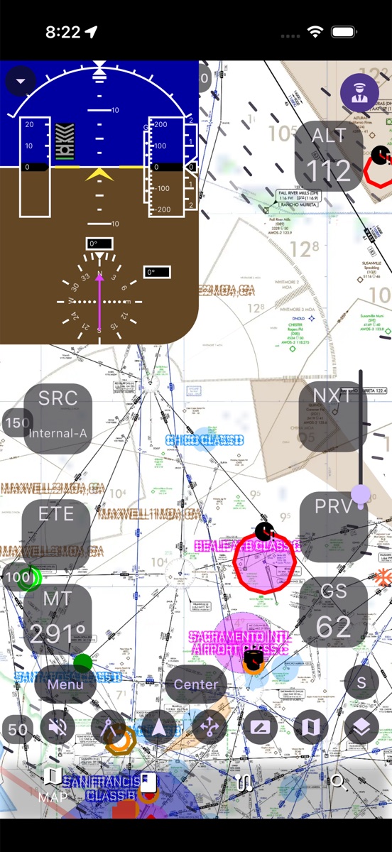
FAA charts and a moving map you can trust
Fly the sectional, TAC, flyway, helicopter, and IFR enroute charts with a georeferenced ownship — track-up or north-up, with range, speed and glide rings.
- VFR & IFR charts plus a vector map with airspace
- Movable instrument tiles: GS, ALT, track, ETA, ETE & more
- Topo & color-coded terrain and elevation layers
- Download once, then fly fully offline
Weather, winds and layers at a glance
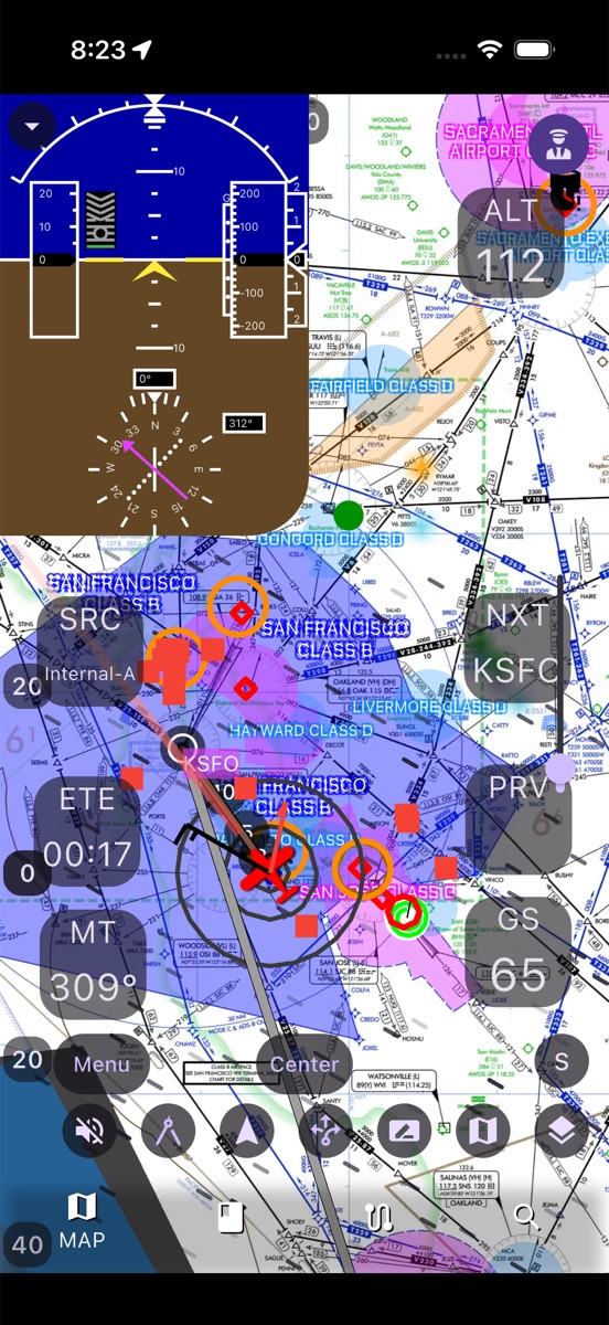
Layer live and FIS-B weather right on the map and make a confident go/no-go call.
- METAR, TAF, PIREP, AIRMET, SIGMET & TFRs, color-coded
- Animated internet radar and ADS-B/FIS-B NEXRAD
- Winds-aloft vector field and ceilings at any altitude
- WPC surface/prog, SigWx, icing & turbulence products
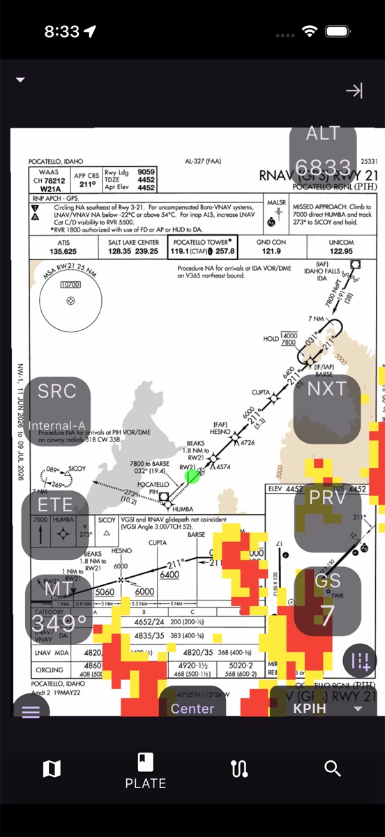
Geo-referenced approach plates
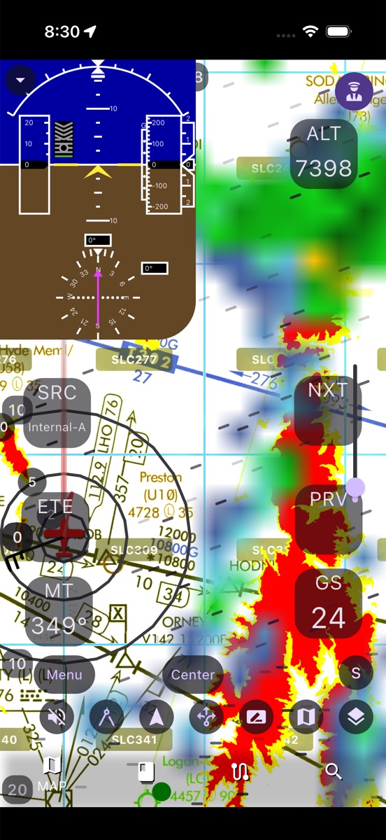
Shoot approaches with your ownship drawn right on the plate, and layer weather on the procedure so you always know what's ahead.
- Approach plates, airport diagrams, departures & STARs
- Ownship position drawn on georeferenced plates
- Airport info, runways, NOTAMs, FBOs & alternates
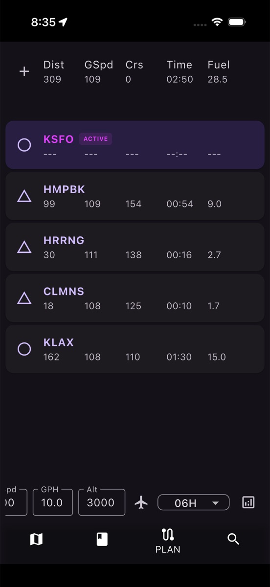
Plan every leg, then file in seconds
Build a route, review a per-leg nav log with distance, ground speed, time and fuel, then file with the FAA without leaving AvareX.
- Per-leg distance, ground speed, time & fuel burn
- Winds & terrain en-route profile
- IFR preferred routes and recent ATC routes
- File, brief, activate & close FAA plans (1800wxbrief / LMFS)
Capabilities pilots count on
Moving Map & Charts
VFR sectional, TAC, flyway, heli and IFR enroute, with georeferenced ownship.
Approach Plates
Geo-referenced plates, airport diagrams, SIDs & STARs with ownship drawn on the plate.
ADS-B Traffic
Stratux, Stratus, Echo & other GDL90 receivers, with audible alerts and GPWS.
Weather
METAR, TAF, NEXRAD, winds aloft, TFRs and more — color-coded by category.
W&B & Performance
Interactive CG envelope plus takeoff, landing and cruise numbers.
Logbook
Currency tracking, CSV import/export, and auto entries from your tracks.
Pilot Community
Public and private groups, shared flight plans, photos, and discussion threads — free with a sign-in on iOS and Android.
Aircraft Scheduler
A shared booking calendar and dispatch board for clubs, partnerships, and flight schools — free with a sign-in on iOS and Android.
Cloud backup
Back up and restore your app data across devices. Free with a sign-in on iOS and Android.
Flight Intelligence
Ask aviation questions with AI. Optional Pro, $5/month, on iOS and Android.
A full EFB that also runs where others don't
| Capability | Typical paid EFB | AvareX |
|---|---|---|
| VFR/IFR moving map + geo-ref ownship | paid plan | Free core |
| Geo-referenced approach plates | paid plan | Free core |
| ADS-B traffic (Stratux/GDL90) | paid plan | Free core |
| Weather, winds aloft, NEXRAD | paid plan | Free core |
| Flight planning + file FAA plans | paid plan | Free core |
| Cloud backup, community & scheduler | paid plan | Free with sign-in (iOS/Android) |
| Flight Intelligence AI | paid extras | Pro $5/mo (iOS/Android) |
| Runs on Android, Windows, Linux | — | Yes |
| Price | ~$120–$300/yr | $0 to start · AI Pro $5/mo |
Backed by an active pilot community
Thousands of pilots ask, answer, report bugs and shape AvareX in the Apps4Av forum — and the team replies.
Start free. Upgrade only if you want more.
No trial countdown and no paywall on the core electronic flight bag.
AvareX
- Moving map & FAA charts
- Geo-referenced approach plates
- ADS-B traffic & weather
- Flight planning, nav log & FAA filing
- Weight & balance, performance & logbook
- Offline charts on every platform
- Cloud backup, community & scheduler (iOS/Android, sign-in)
AvareX Pro
- Everything in the free app
- Flight Intelligence AI assistant
- Ask aviation and trip questions in the app
- Cancel anytime
Frequently asked questions
Is AvareX free?
Yes. The core AvareX electronic flight bag is free to download and fly, including the moving map, FAA charts, geo-referenced approach plates, ADS-B traffic, weather, and flight planning. Cloud backup and sync, the pilot community, and the aircraft scheduler are also free — sign in on iOS or Android. The only paid add-on is Flight Intelligence, an optional $5/month Pro subscription on iOS and Android.
Is AvareX a free alternative to ForeFlight?
AvareX is a full electronic flight bag with a free core (charts, plates, ADS-B traffic, weather, and flight planning) and an optional $5/month Pro add-on for Flight Intelligence AI — compared with the roughly $120–$300 per year that comparable paid EFB apps such as ForeFlight charge. AvareX also runs on Android, Windows, Linux, and Raspberry Pi in addition to iOS.
Does AvareX work on Android?
Yes. AvareX runs on Android, iOS, Windows, macOS, Linux, and Raspberry Pi, so you are not limited to an iPad.
Does AvareX support ADS-B traffic?
Yes. AvareX connects to Stratux, Stratus, Echo, and other GDL90 receivers over Wi-Fi to display ADS-B traffic with altitude offset, trend, and audible alerts, plus a Ground Proximity Warning System (GPWS).
Does AvareX work offline?
Yes. Core navigation works fully offline once you download the charts and databases. Internet is only required for downloads, live weather, AI features, FAA plan filing, and cloud backup.
How much does AvareX Pro cost?
AvareX Pro is $5 per month on iOS and Android. It unlocks Flight Intelligence, the AI assistant. Cloud backup and sync, the pilot community, and the aircraft scheduler are free with a signed-in account and do not require Pro.
Is AvareX FAA-certified?
No. AvareX is not an FAA-certified GPS and must not be used as a sole means of navigation. Always cross-check with official sources and certified equipment.
Ready to fly with AvareX?
Free to download and fly. Flight Intelligence Pro is $5/month on iOS and Android — cancel anytime.